Saturday, October 13, 2007

Pictured Rocks National Lakeshore Part 3 - Lessons Learned, Gear, and Files

Lessons Learned

  1. Don't trust mapping programs. They are a helpful utility, but always review a good old-fashioned paper map first to make sure they're not leading you down a treacherous 12-ft wide dirt road when you could be on a paved four-lane highway.
  2. Use appropriate zoom level with GPS devices. Given the size of the earth, GPS is amazingly accurate. Even if it could pin-point your position down to a few inches, however, when a mapping program is zoomed out, it is difficult to tell your exact location with regard to your route.
  3. Research campsites ahead of time. Carrying a 2 lbs. 9 oz, 9x9x13 inch bear canister to a camp-site with both a bear locker and a bear pole was a painful mistake.
  4. Pack a sheet of paper with standard volumetric unit conversions on it to aid accurate measurment when cooking.
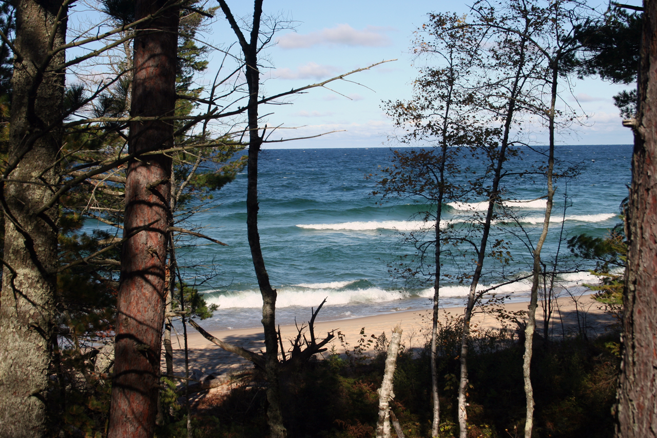
  5. Try not to backtrack. We hiked 14 miles, but only saw 7 miles worth of scenery. Shuttle services take hikers from one end of pictured rocks to another for a small fee.


Gear

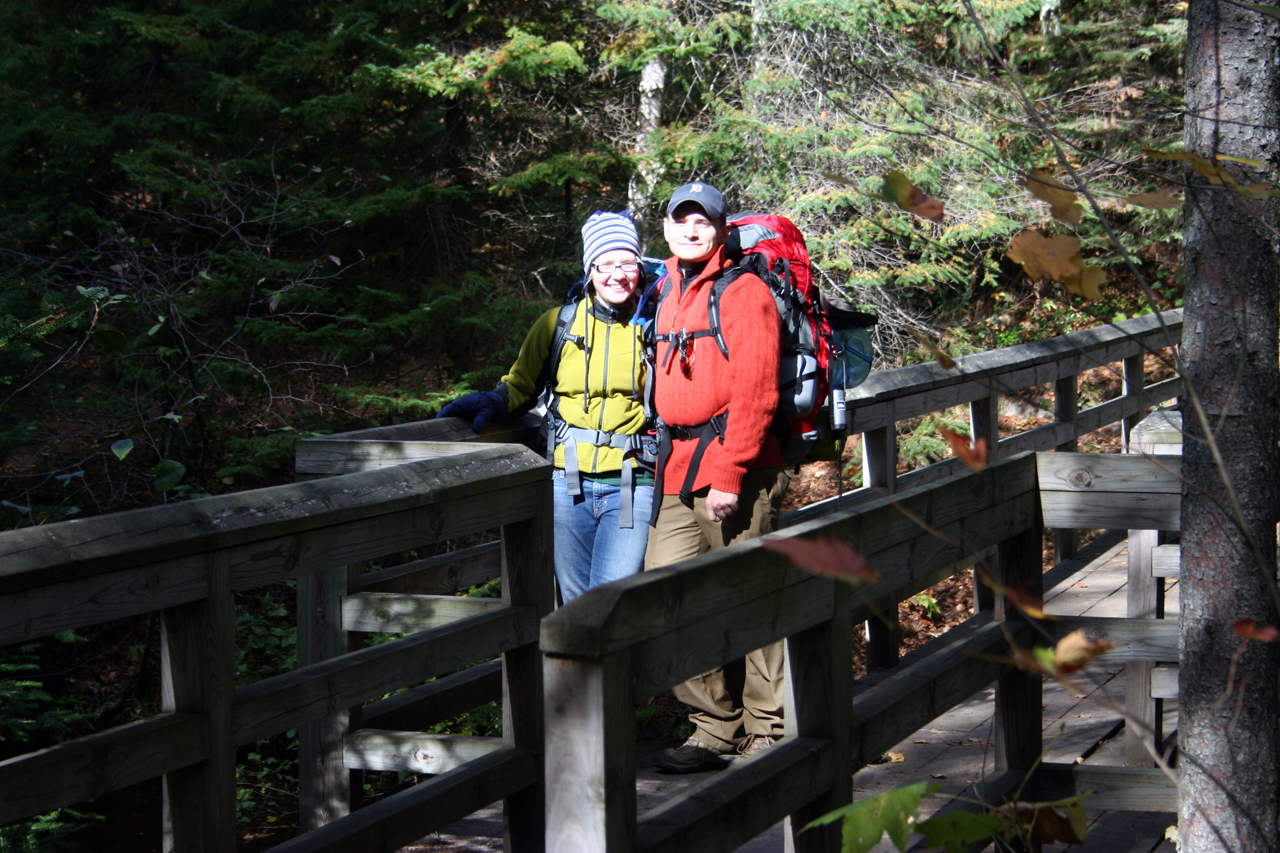
Packs: I carried the Osprey Atmos 65, and Sara carried the women's counterpart, the Osprey Aura 65. We both found the packs roomy enough for a cool weekend hike, but we also both noticed the shoulder straps lacked sufficient padding. These are great packs for the price, however. We both had a REI Duck's Back Rain Cover for 60L packs in case it rained. These easily fit over our packs. I had a CamelBak OMEGA Hydration 70 oz Reservoir in my pack from which we both drank.

Tent: Sierra Designs Lightning 2-person, 3-season tent. This is a standard tent with rain-fly. It goes up without hassle, and it does its job well. It was a little cramped with the two of us and all our gear, but we could have left the gear outside under the rain-fly.

Sleeping bags: I used the REI Sub Kilo +20 down bag, and Sara used the women's equivalent REI Sub Kilo +15 down bag. They pack very small -- about the size of a football -- and are very light. I found my bag to provide plenty of insulation. Sara, however, was very cold in hers. We both used Sea To Summit Ultra-Sil Medium 11 x 18 Dry Sacks to keep our sleeping bags dry in case of rain or unintended contact with water. These were great dry sack, and I could fit a few pair of extra socks and some other clothes along with my sleeping bag.

Sleeping pads: We both used the REI Lite Core 1.5 Self Inflating Pads, though Sara again used the women's version. Mine did well to keep me insulated from the cold ground. Sara was cold, but she slept on her side, possibly compromising the pad's ability to keep her off the ground. They both pack down to very small sizes, and they're both quite light.

Footwear: My hiking boots are Merrell Pulse II's. They kept me warm and dry, though I did have a few blisters on my heels after hiking 14 miles. Sara wore old cross-trainers that were comfortable, but cold. She has since bought proper hiking boots.

Base-layer: We both wore REI MTS Lightweight underwear, and we both liked it a lot. It has 0% cotton, so it doesn't get damp. It also is stretchy, snug, and warm. I'm considering a set of the mid-weight underwear for colder pursuits this winter.
Men's half-zip top, Men's bottom, Women's half-zip top, Women's bottom

Pants: I wore Columbia nylon pants; Sara wore jeans. I'm glad it didn't rain.

Layering: I just wore a zip-neck wool sweater, which kept me warm most of the trip. Sara had an REI fleece, though I'm not sure of the model.

Coat: We both had waterproof Columbia Titanium coats with removable fleece liners. Neither of us wore them except for at the camp-site when we were making dinner. Otherwise we packed them. I'm glad we brought them, however, because dinner would have been very cold in just a sweater.

Accessories: Sara wore a wool/fleece winter hat. I wore a baseball cap but brought an REI Taku Sombrero in case it rained, but ended up not needing it.

Water purification: We took one First Need Deluxe Water Purifier with us. I love this thing. Just dip one end in any water, screw a Nalgene bottle onto the pump/filter, pump for 3 minutes, and you have a liter of fresh, clean, parasite-free water. It tastes wonderful. I'm very happy I bought this.

Stove: Primus EtaPower Easy Fuel Stove. This did the job, and it heats water very quickly, but it's very bulky and the pizo-electric lighter is unreliable. When packed in one of our Atmos/Aura packs, it took a giant chunk of space in the bottom and didn't allow much else around it. I'd prefer a taller, narrower unit like the MSR Reactor. Also, after using it to cook dinner for one night (appox 3L water), I couldn't get it to light for breakfast the next morning. I could hear the gas flowing, but the ignitor wouldn't light the flame. I had matches, but I didn't want to hike 5 miles back to my car with third degree burns on my hands and face. I later tried lighting it with long matches at home, and it fired right up, confirming my suspicion that I didn't burn it out of fuel on my one night of cooking.

GPS: I rigged an old Dell Axim x50v to work with a compact flash GPS receiver. I used BackCountry Navigator for a mapping/topo program. This failed so miserably that soon after the hike I bought a Garmin GPSMap 60CSx instead. For some reason the topo maps I loaded to BackCountry Navigator at home wouldn't load up on the trail. Worse, the battery life of about 3.5 hours for the PDA is worthless for an on-trail navigation aid. The GPSMap works for about 20-26 hours on 2 AA's. Of course I brought a standard Silva compass along with a trail map just in case we got lost.

Files

Coming soon

Pictured Rocks National Lakeshore Part 2 - The Hike

(please read Part 1 first)

And help came. We pulled our sleeping bags out of our packs and snuggled up in the Neon. About 5:00 AM, I saw headlights a long way off behind the car. They started to grow closer, and I got out and waved down the red pick-up that was making its way down the grade. The driver, a local hunter, stopped and acknowleged me but said it was still to dark to pull me out yet. He assured me that many hunters traveled this route and that more would be by later.

Sure enough, about 2-3 hours later a group of hunters in two large 4x4 pick-up trucks came down the road. They were very friendly, and although I was only hoping they could send for a tow-truck, the driver insisted that he pull me out, himself. He grabbed some chain from his truck and hooked one end to the front of his truck. The othe end he attached to the rear of my car's frame with a steel hook. He then told me to get in and steer, and proceeded to tow me out -- in reverse -- through what seemed like at least a mile of sandy grade. They're not very fuel efficient, but those 4x4's are really impressive! Once I was back onto a proper dirt road, he unhooked the chain, but couldn't free up the steel hook from my car's frame. I wasn't sure if I should have given him some cash for the hook, or just said thanks, but I chose the latter so as not to seem... I guess patronizing is the best word. They drove off after I wished them a good hunt, and Sara and I headed to the Interagency Visitors Center in Munising:


View Larger Map

This serves as a visitors center for both the Pictured Rocks National Lakeshore and the nearby Hiawatha National Forest

At the visitor center, we registered for one night of back-country camping, but they made you choose which campsite you would stay at ahead of time. We took a little while studying the map and estimating how far we could make it in the one-and-a-half days we had left. In the end, we chose to drive to Miner's Castle, park, hike south to the cliffs with only very light gear, turn around and hike back to Miner's Castle, then pick up the rest of our gear and hike north to the Mosquito campground.

You can download a nice PDF map of Pictured Rocks here.

You can find GPS coordinates here.

You can get the milege chart here.

Here's the base map:


The zoomed area shows our route:


We hiked 9 miles on Saturday. The coniferous forest just north of Miner's Castle near the Miner's River is absolutely beautiful!


Miner's Beach also offered Kodak moments:


We reached Mosquito campground around 3:00 PM and set up camp. We planned to go out to the beach to watch the sunset, but we were bo so exhausted from the previous night's adventure and the day's hike that we fell asleep as soon as we had our tent set up. Here's the campsite:


(we planned to take more pictures after the tent was up, but we were too tired)

We woke up around 7:30 PM to eat and get ready for bed. The campsite had a bear locker and a bear pole, but I wasn't aware of this ahead of time, so I stupidly carried my bear canister for the entire hike:


After a dinner of watery rice, lentils, and miso soup, we cleaned up, bundled up, and slept for the night. Or at least I did. Sara froze and didn't sleep much. The temperatures were in the mid thirties to low forties -- no colder than the previous night -- but we've both concluded that she didn't use her sleeping bag or sleeping pad correctly, leaving the bag open too far and focally compressing the pad too much by lying on her side.

At around 8:00 AM the next morning we awoke and packed up. The 5-mile hike back to the car seemed to take half the time it took to cover the same distance the previous day. While driving home we stopped for some meat-pies for lunch, snapped a few pictures of the Mackinaw bridge, and picked up some taffy and fudge in Mackinaw city. All-in-all, it was a very enjoyable, very memorable trip, and we plan to go back next year.

Pictured Rocks National Lakeshore Part 1 - Stuck in the Sand

This trip was our first shot at back-country camping. It was a minor success, to put it graciousy. The plan was to leave Detroit early Friday afternoon and make the 6-hour drive with enough time to fix dinner and set-up camp for the evening. Here's the map for our trip up:


View Larger Map

Even though we packed everything the night before, we weren't able to leave Detroit until about 3:30 PM on Friday. Already we were three and a half hours behind schedule. We met all kinds of traffic on I-75 on the way up, and we didn't make it to the Upper Peninsula until after midnight.

We had set up a laptop with a USB GPS receiver and loaded on Microsoft Streets and Trips 2007. It directed us well until about 6 miles from our final destination --the drive-in campground at Little Beaver Lake. We were on M-28, a nice, paved highway when it told us to take a right onto the Creighton Truck Trail. This was a rough and very narrow dirt road with plenty of quick turns. We were a little dubious at first, but we trusted the text-to-speech voice of Streets and Trips, which we named "Wanda." This was our first mistake... Here are the directions from maps.google.com and Streets and Trips side-by-side:


Note how Google Maps keeps us on main roads and takes us through three towns, as opposed to Streets and Trips' route.

We continued on, even though at spots the tree branches were hanging down low enough over the road to touch the top of our tiny Dodge Neon. There were multiple forks in the road, but Wanda guided us well. Then came a very narrow fork. We weren't sure which way to go, so we took what appeared to be the more traveled path. We later found out that this was not a road, per se, but "the grade."

The grade is a route wide enough for one vehichle. It is made up of sand that is over a foot deep, and to the best of my knowedge, it's unmarked in all but special maps. Well, as we turned onto the grade, Wanda started complaining about us being "off route." We weren't sure what she was trying to tell us, because as we looked at her map, our pointer was right on top of the route, or so we thought... When we zoomed in, we found that we were actually east of where we were supposed to be, so we stopped and tried to back up. This was the fatal error. The wheels dug into the 18-inch deep sand, and our little neon was stuck.

We got out and tried to dig her out, but to no avail. We actually did get her moving once by jacking the car out of the sand and placing logs under the front tires, but we just got stuck again after another 100 yards. We were stuck in the woods, on what we believed to be a seldomly-traveled trail in the cold, and well out of cell-phone reception areas. We debated whether we should try to hike west to Melstrand right away or wait until morning. By now it was past 3:30 AM, and we were both exhausted from digging, so we decided to rest. Before falling off to sleep, though, we said a brief prayer for help...