And help came. We pulled our sleeping bags out of our packs and snuggled up in the Neon. About 5:00 AM, I saw headlights a long way off behind the car. They started to grow closer, and I got out and waved down the red pick-up that was making its way down the grade. The driver, a local hunter, stopped and acknowleged me but said it was still to dark to pull me out yet. He assured me that many hunters traveled this route and that more would be by later.
Sure enough, about 2-3 hours later a group of hunters in two large 4x4 pick-up trucks came down the road. They were very friendly, and although I was only hoping they could send for a tow-truck, the driver insisted that he pull me out, himself. He grabbed some chain from his truck and hooked one end to the front of his truck. The othe end he attached to the rear of my car's frame with a steel hook. He then told me to get in and steer, and proceeded to tow me out -- in reverse -- through what seemed like at least a mile of sandy grade. They're not very fuel efficient, but those 4x4's are really impressive! Once I was back onto a proper dirt road, he unhooked the chain, but couldn't free up the steel hook from my car's frame. I wasn't sure if I should have given him some cash for the hook, or just said thanks, but I chose the latter so as not to seem... I guess patronizing is the best word. They drove off after I wished them a good hunt, and Sara and I headed to the Interagency Visitors Center in Munising:
View Larger Map
This serves as a visitors center for both the Pictured Rocks National Lakeshore and the nearby Hiawatha National Forest
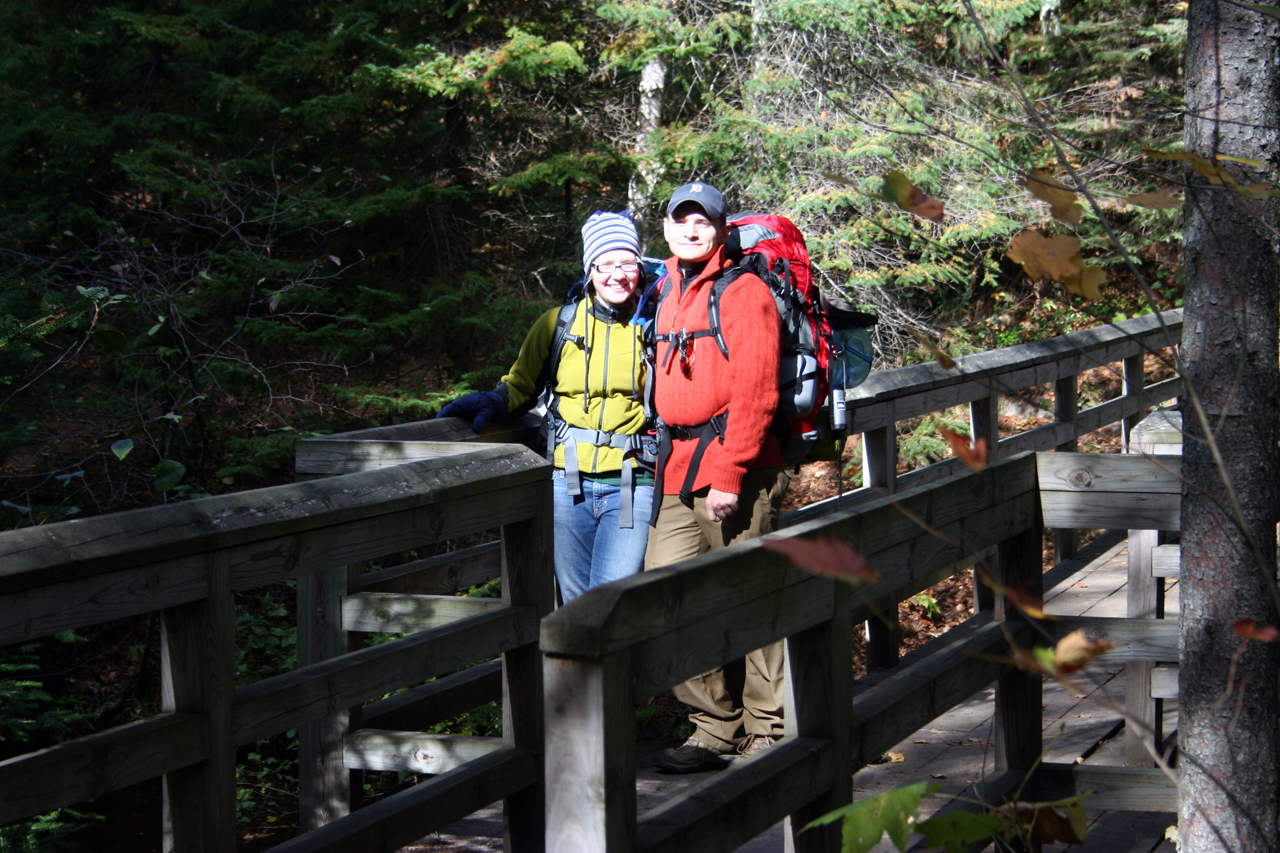
At the visitor center, we registered for one night of back-country camping, but they made you choose which campsite you would stay at ahead of time. We took a little while studying the map and estimating how far we could make it in the one-and-a-half days we had left. In the end, we chose to drive to Miner's Castle, park, hike south to the cliffs with only very light gear, turn around and hike back to Miner's Castle, then pick up the rest of our gear and hike north to the Mosquito campground.
You can download a nice PDF map of Pictured Rocks here.
You can find GPS coordinates here.
You can get the milege chart here.
Here's the base map:

The zoomed area shows our route:

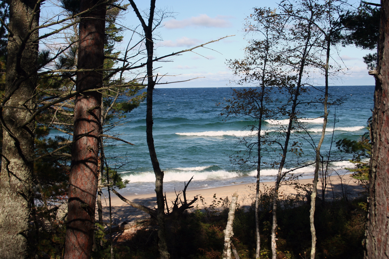
We hiked 9 miles on Saturday. The coniferous forest just north of Miner's Castle near the Miner's River is absolutely beautiful!

Miner's Beach also offered Kodak moments:


We reached Mosquito campground around 3:00 PM and set up camp. We planned to go out to the beach to watch the sunset, but we were bo so exhausted from the previous night's adventure and the day's hike that we fell asleep as soon as we had our tent set up. Here's the campsite:

(we planned to take more pictures after the tent was up, but we were too tired)
We woke up around 7:30 PM to eat and get ready for bed. The campsite had a bear locker and a bear pole, but I wasn't aware of this ahead of time, so I stupidly carried my bear canister for the entire hike:

After a dinner of watery rice, lentils, and miso soup, we cleaned up, bundled up, and slept for the night. Or at least I did. Sara froze and didn't sleep much. The temperatures were in the mid thirties to low forties -- no colder than the previous night -- but we've both concluded that she didn't use her sleeping bag or sleeping pad correctly, leaving the bag open too far and focally compressing the pad too much by lying on her side.
At around 8:00 AM the next morning we awoke and packed up. The 5-mile hike back to the car seemed to take half the time it took to cover the same distance the previous day. While driving home we stopped for some meat-pies for lunch, snapped a few pictures of the Mackinaw bridge, and picked up some taffy and fudge in Mackinaw city. All-in-all, it was a very enjoyable, very memorable trip, and we plan to go back next year.

No comments:
Post a Comment